


Mount Muhabura Hike | Summit "The Guide" Volcano
Mount Muhabura, known as "The Guide" for its prominent position visible across the region, stands at 4,127 meters as the third-highest peak in the Virunga Mountains. This challenging one-day Mount Muhabura hike rewards determined climbers with spectacular 360-degree summit views spanning Rwanda, Uganda, and the Democratic Republic of Congo.
The Mount Muhabura climb is perfect for experienced hikers seeking a demanding yet achievable high-altitude trek with panoramic rewards that surpass even taller Karisimbi.
Mount Muhabura Overview
- Elevation: 4,127 meters (13,540 feet)
- Duration: 8-10 hours round trip (one day)
- Distance: Approximately 12km round trip
- Difficulty: Challenging
- Permit Cost: $100 USD
- Best Time: June-September, December-February
- Summit Feature: 360-degree panoramic views, small summit crater
- Minimum Age: 15 years
- Name Meaning: "The Guide" (always visible across the region)
Why Climb Mount Muhabura?
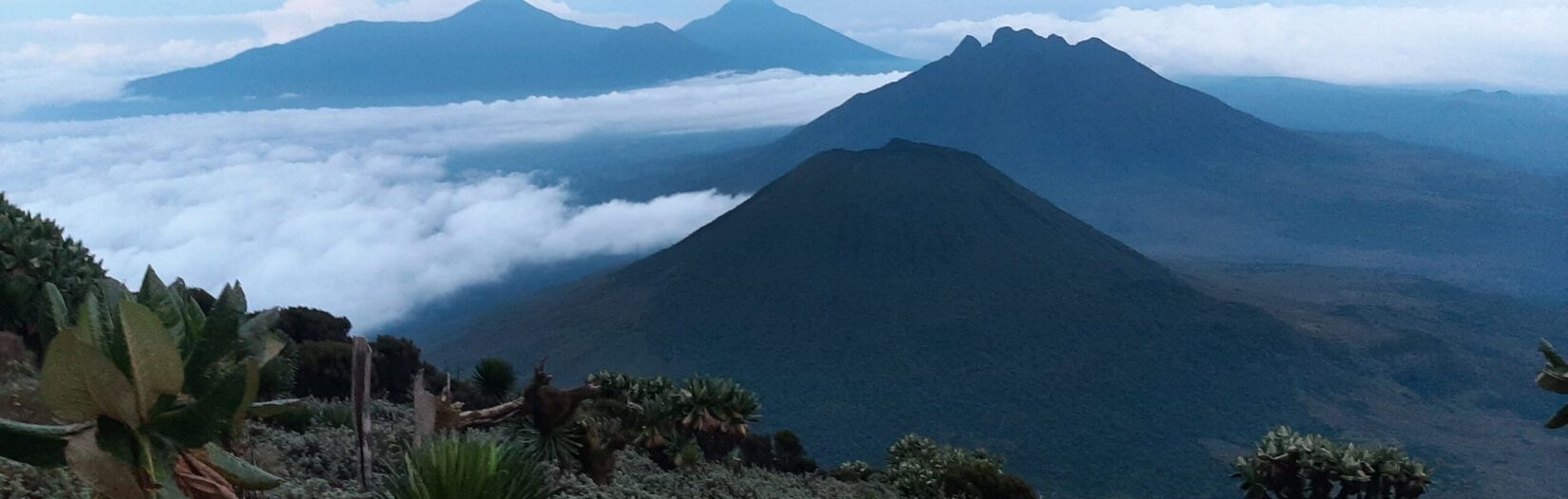
Unmatched Summit Views: Mount Muhabura offers the best summit panorama of any Virunga volcano. The cone-shaped peak provides unobstructed 360-degree views—see all other Virunga volcanoes, Lake Kivu, Rwanda's terraced hillsides, Uganda's landscape, and DRC's Nyiragongo crater on exceptionally clear days.
The Perfect Cone: Muhabura's classic volcanic cone shape makes it one of the most photographed peaks in the Virunga range. The symmetrical profile is stunning from a distance and rewarding to summit.
High Altitude Challenge: At 4,127m, Muhabura offers serious altitude without requiring overnight camping. It's an excellent acclimatization hike before attempting Karisimbi or a worthy summit in its own right.
Less Crowded: While Bisoke attracts more hikers, Mount Muhabura sees fewer trekkers, offering a more solitary mountain experience for those seeking quieter trails.
Border Position: The summit sits on the Rwanda-Uganda border, allowing hikers to literally stand in two countries simultaneously—a unique photo opportunity.
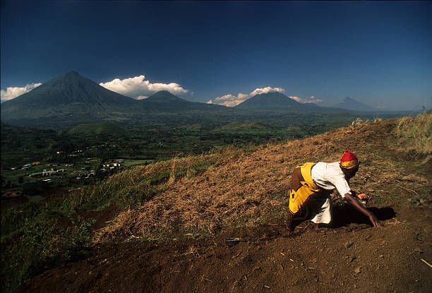
Diverse Terrain: Experience steep bamboo forests, open moorlands, rocky scrambles, and high-altitude alpine zones in a single day's trek.
Mount Muhabura Hike Itinerary
6:30 AM - Early Start at Park Headquarters
Arrive at Volcanoes National Park headquarters in Kinigi for registration and pre-hike briefing. Mount Muhabura requires an early start due to the long hiking day. Hire porters ($15-20)—recommended for this challenging climb.
7:00 AM - Transfer to Trailhead
Drive to the Mount Muhabura trailhead on the park's eastern side, near the Uganda border.
7:30 AM - Hike Begins (2,500m)
Start climbing immediately through cultivated fields before entering dense bamboo forest. The trail is steep from the outset, gaining elevation quickly.
8:30 AM - Bamboo Forest Zone
Trek through thick bamboo groves where mountain gorillas feed. The trail is steep, narrow, and often muddy. Expect to grab bamboo stems for support on the steepest sections.
10:00 AM - Hagenia Forest Transition
Emerge from bamboo into hagenia-hypericum woodlands. The forest opens slightly, providing glimpses of neighboring volcanoes. Continue the relentless upward climb.
11:30 AM - Alpine Moorland
Break through the treeline into open moorland dotted with giant senecio and lobelia plants. The vegetation thins dramatically, revealing expansive views. The trail becomes rockier.
12:30 PM - Final Summit Push
The last 300 meters are the most challenging—steep, loose volcanic rock requiring careful footing. The air is noticeably thinner at this altitude. Push through for the summit prize.
1:00 PM - Summit Mount Muhabura (4,127m)
Reach the summit cone with its small crater. Enjoy absolutely breathtaking 360-degree views:
- North: Mount Gahinga and Mount Sabyinyo
- West: Mount Karisimbi, Bisoke, and Lake Kivu
- South: Rwanda's terraced hillsides
- East: Uganda's landscape
- DRC: Nyiragongo and Nyamuragira volcanoes (on clear days)
Stand on the Rwanda-Uganda border marked at the summit. Have lunch, celebrate, and soak in the panorama.
2:00 PM - Descent Begins
Start the long descent back through the alpine zone. Downhill is hard on knees and can be slippery—poles essential.
3:30 PM - Back to Treeline
Re-enter the forest zone. The descent through bamboo is steep and requires concentration.
5:00 PM - Arrive at Trailhead
Complete your Mount Muhabura climb. Receive your certificate and transfer to accommodation.
Total Duration: 8-10 hours (varies by fitness level and trail conditions)
Mount Muhabura Difficulty Rating
Mount Muhabura is rated challenging and is the most difficult one-day volcano hike in the park:
Why It's Challenging:
- Steep, sustained climbing: 1,627m elevation gain with few flat sections
- Long hiking day: 8-10 hours of continuous trekking
- High altitude: 4,127m—altitude sickness possible
- Technical sections: Rocky summit scramble requires sure-footedness
- Physical endurance: Tests both cardiovascular fitness and leg strength
- Trail conditions: Often muddy, slippery, and overgrown in places
Fitness Requirements:
- Excellent cardiovascular endurance
- Strong leg muscles for steep climbs and descents
- Previous hiking experience recommended
- Ability to hike 8+ hours with short breaks
- Comfortable with exposure on steep slopes
Compared to Other Volcanoes:
- More difficult than: Bisoke, Dian Fossey tomb
- Less difficult than: Karisimbi (due to single-day format)
- Similar difficulty to: Sabyinyo (different challenges)
Success Rate: Approximately 80% of hikers reach the summit. Weather, fitness, and altitude are the main factors affecting success.
What to Bring for Mount Muhabura
Essential Gear
Footwear:
- Waterproof hiking boots with excellent ankle support (crucial)
- Gaiters (mandatory—trails are very muddy)
- Quality hiking socks (prevent blisters on long descent)
Clothing:
- Waterproof jacket (rain likely)
- Waterproof pants
- Moisture-wicking base layer
- Warm mid-layer (fleece or light down)
- Long-sleeve shirt (protect from vegetation)
- Warm hat and gloves (summit is cold)
- Sun hat
- Long pants (shorts not suitable)
Equipment:
- 30L daypack (or porter to carry it)
- Walking poles (absolutely essential for descent)
- 3 liters of water (stay well-hydrated)
- High-energy snacks (trail mix, energy bars, chocolate, dried fruit)
- Packed lunch
- Sunscreen SPF 50+
- Sunglasses
- Camera (protect from rain)
- Headlamp (in case descent runs late)
Recommended:
- Porter service ($15-20)—lighten your load
- Garden gloves (grabbing vegetation on steep sections)
- Knee support/brace (if prone to knee pain)
- Trekking pole rubber tips (for rocky sections)
- Electrolyte tablets
- Blister prevention (tape, bandages)
- Small first aid kit
- Altitude sickness medication (consult doctor)
Best Time to Climb Mount Muhabura
Dry Season (Best Conditions):
- June-September: Optimal climbing season with drier trails and clearer skies
- December-February: Excellent weather, stunning visibility for summit views
- Advantages: Less mud, easier footing, better panoramic views, lower rainfall
- Book ahead: 1-2 months advance for peak season
Wet Season:
- March-May (Long Rains): Heaviest rainfall, very muddy and slippery trails
- October-November (Short Rains): Moderate rainfall, challenging conditions
- Challenges: Extremely muddy bamboo forest, slippery rocks, limited visibility, cold summit conditions
- Advantages: Fewer hikers, lush vegetation, dramatic cloudscapes
- Reality: Muhabura is hikeable year-round for determined adventurers
Weather Considerations:
- Mountain weather unpredictable any time of year
- Morning starts increase chance of clear summit views
- Cloud cover often develops afternoon
- Summit temperatures: 0°C-10°C (32°F-50°F)
- Rain possible any day—always be prepared
Mount Muhabura Pricing
Permit Cost: $100 USD per person
What's Included:
- Park entrance fees
- Certified mountain guide (park ranger)
- Armed ranger escort
- Trail access to summit
- Summit certificate
Additional Costs:
- Porter service: $15-20 per person (highly recommended)
- Walking pole rental: $5-10
- Guide and porter tips: $15-25 total suggested
- Transport to/from trailhead
- Personal gear and equipment
Total Estimated Cost: $130-150 per person (including porter and tips)
Safety Considerations
Altitude Awareness: At 4,127m, altitude sickness is possible. Symptoms include headache, nausea, dizziness, and fatigue. Inform your guide immediately if you feel unwell. Ascending slowly helps prevent altitude issues.
Physical Limits: This is a demanding hike. There's no shame in turning back if you're struggling. Your guide will support your decision and ensure safe descent.
Weather Risks: Mountain weather can deteriorate rapidly. Guides monitor conditions and may turn groups back in severe weather.
Trail Hazards: Steep, slippery sections require concentration. Use your porter's assistance and take your time.
Wildlife: Buffalo and elephants inhabit the area. Armed rangers provide protection. Follow guide instructions if wildlife is encountered.
Emergency Protocols: Guides carry first aid equipment and communication devices. Evacuation procedures are in place for serious injuries or medical emergencies.
Combining Mount Muhabura with Other Hikes
Three-Peak Challenge (4 Days)
- Day 1: Mount Bisoke crater lake
- Day 2: Rest day or Dian Fossey tomb
- Day 3: Mount Muhabura summit
- Day 4: Golden monkey tracking
- For serious hikers: Experience multiple volcanoes
Gorilla & Summit Package (3 Days)
- Day 1: Mountain gorilla trekking
- Day 2: Mount Muhabura climb
- Day 3: Cultural village visit or rest
- Perfect combination of wildlife and adventure
Border Volcanoes (2 Days)
- Day 1: Mount Muhabura (Rwanda-Uganda border)
- Day 2: Mount Sabyinyo (Rwanda-Uganda-DRC border)
- Unique focus: Summit both border peaks
Ultimate Volcano Week
- Combine all major volcano hikes in one trip
- Include gorilla trekking and golden monkeys
- For volcano enthusiasts: Complete Virunga experience
Booking Your Mount Muhabura Climb
How to Book:
- Contact us 2-4 weeks in advance (minimum 1 week)
- Confirm your preferred date
- We secure your climbing permit
- Receive confirmation and preparation guide
- Enjoy your Mount Muhabura adventure!
What We Provide:
- Hiking permit and park fees
- Professional park ranger guide
- Armed ranger escort
- Transport from Kigali or local area to trailhead
- Pre-hike briefing and safety orientation
- Porter coordination (if requested)
- Summit certificate
- Post-hike transfer to accommodation
Preparation Tips:
- Train with uphill hiking in the weeks before
- Stay hydrated in days leading up to the climb
- Get good sleep the night before
- Eat a substantial breakfast
- Consider doing Bisoke first for acclimatization
Ready to Summit? Contact us to book your Mount Muhabura climb or ask any questions about this challenging volcano trek.
Mount Muhabura FAQs
Q: How does Muhabura compare to Karisimbi? A: Muhabura is lower (4,127m vs 4,507m) but nearly as challenging due to steepness and completing it in one day. Muhabura has better summit views but Karisimbi has the prestige of being Rwanda's highest.
Q: Which has better views—Muhabura or Bisoke? A: Muhabura has superior panoramic views from the summit. Bisoke has the dramatic crater lake. Both are spectacular for different reasons.
Q: Do I need altitude acclimatization? A: While not mandatory for Muhabura's altitude, spending a day or two in Kigali (1,500m) or doing Bisoke first helps. Ascend slowly on the hike itself.
Q: Can I do Muhabura and another volcano on the same day? A: No, absolutely not. Muhabura alone requires 8-10 hours of strenuous hiking. You'll need rest afterwards.
Q: Is there water available on the trail? A: No water sources. Bring 3 liters per person. Staying hydrated is crucial at altitude.
Q: What if I can't finish? A: You can turn back any time. Your guide will accompany you down safely. Many hikers turn back due to fatigue, weather, or altitude—it's completely acceptable.
Q: Will I see gorillas on Muhabura? A: Unlikely. Gorillas prefer the lower bamboo forests, which you'll pass through quickly. For gorilla encounters, book a dedicated trekking permit.
Q: How many people climb Muhabura daily? A: Much fewer than Bisoke. Some days only 1-2 groups attempt Muhabura, offering a more solitary experience.
Q: Can I see the summit crater? A: Yes, there's a small crater at the summit, though not as dramatic as Bisoke's. The main attraction is the 360-degree view.